_gold-black.png)
2cofly Completes 5-Mile Transmission Line Mapping for Samsung's Solar Project in Guam
- 2cofly

- Aug 27, 2025
- 2 min read
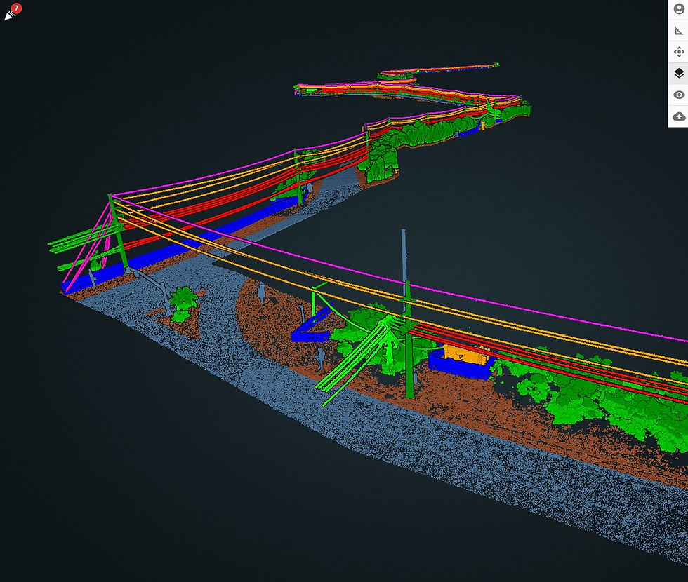
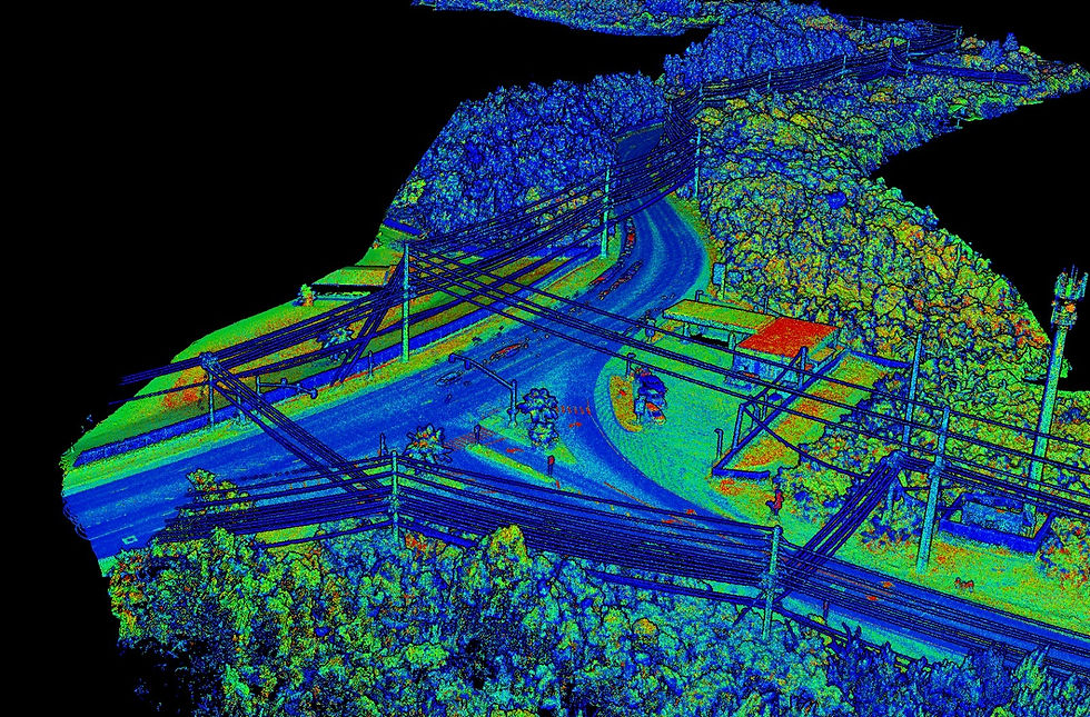
We are proud to announce the successful completion of the second phase of a 10-mile power line infrastructure mapping project in Guam, supporting Samsung’s upcoming solar farm development in Yona. This work will provide the engineering team with accurate, high-resolution datasets to plan, design, and analyze critical infrastructure for the renewable energy project.


To ensure the highest quality deliverables, our team deployed LiDAR sensors, capturing every detail along the transmission corridor. The airspace presented unique challenges—spanning Class G and restricted military zones—but through precise coordination and diligent preparation, we secured military airspace approvals within weeks. Without this clearance, large portions of the project area would have been inaccessible, creating gaps in the dataset.
We approached the 5-mile segment with two drones and two teams, dividing the corridor into 1-mile sections and scanning from the outer ends toward the center. This parallel workflow maximized efficiency while maintaining rigorous safety and data quality standards. Given the military airspace environment, our team maintained constant communication with the Military Watch Commander and Navy Police Desk, ensuring full compliance and operational transparency at all times.
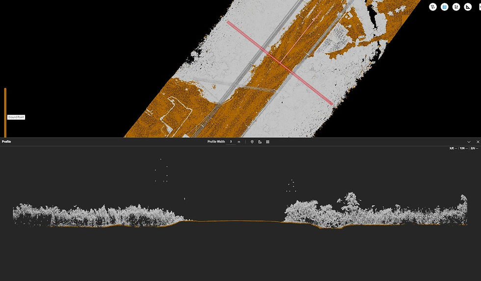
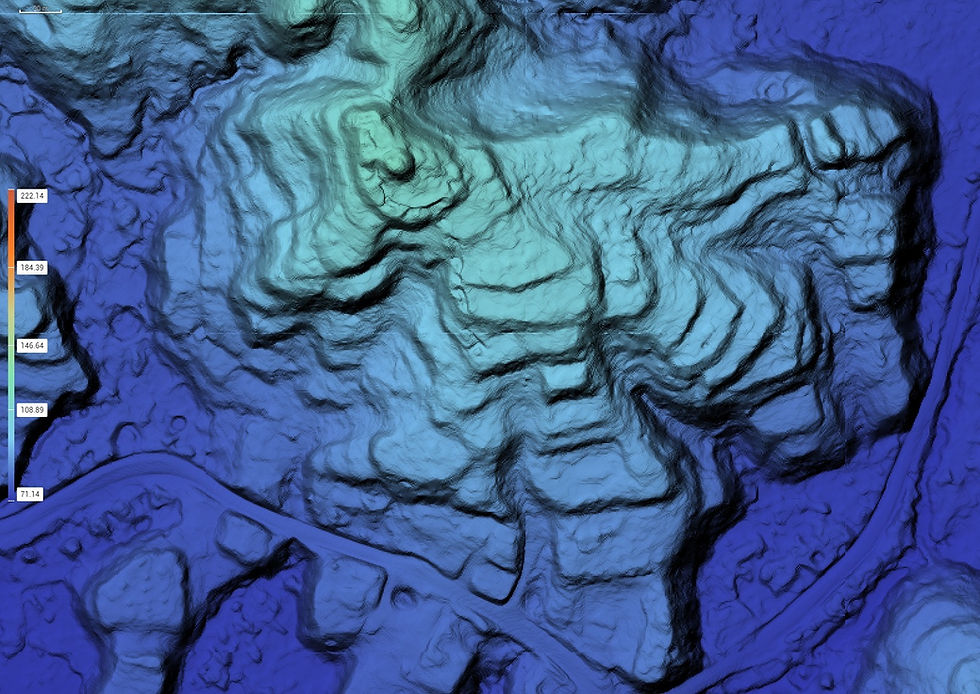
In just four weeks—from initial flight planning to final deliverables—we completed the mission, working alongside TG Engineers who conducted the ground survey. Our outputs included PLS-CADD-processed data, a classified point cloud, a digital elevation model (DEM), and detailed planimetric drawings—all delivered on schedule without compromising quality.
This project underscores 2cofly’s ability to manage complex aerial survey missions in challenging environments while delivering results on time. Whether it’s navigating restricted airspace or integrating advanced sensing technologies, our team has the expertise and commitment to get the job done right.

2cofly is a full service drone service provider in Guam and Micronesia. Our company has two primary focus areas: construction and education.
We work primarily with construction and engineering firms and offer:
Orthomosaic Mapping (+ Planimetric Mapping)
Topographic Mapping (via LiDAR & photogrammetry)
General LiDAR Mapping (land feasibility study, power line, etc)
Aerial Inspection
Aerial Magnetometry (underground metal detection)
Part 107 education and drone training

(671) 988-1532


Comments